


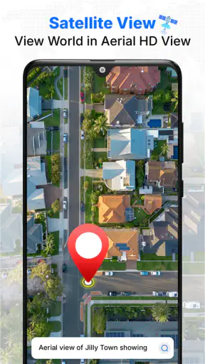
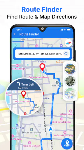
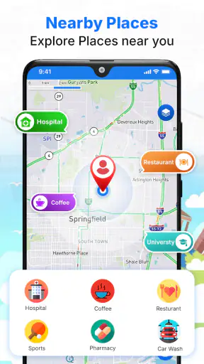
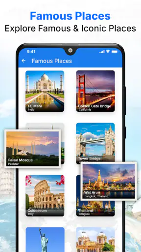
I tested Satellite Map Live Earth View as a travel and local navigation app, focusing not only on whether it can help me find a route, but also on how comfortable it is to use in different situations. Its main appeal is the satellite-map presentation: instead of relying only on conventional road graphics, I can look at a more visual representation of the surrounding area while checking my current position and planning where to go next.
The app is free to download and is suitable for Everyone, which makes it approachable for families, older users, occasional travelers, and people who simply want a quick map view without committing to a paid navigation service. It comes from GPS Driving & Voice Navigation Apps and has reached over five million installs. That level of adoption suggests it is useful to many people, although its average rating of 3.9 shows that the experience is not perfect for everyone.
My overall impression is that this is best understood as a visual map companion rather than an automatic replacement for every established navigation tool. I found it most interesting when I wanted to understand an area from above, identify nearby landmarks, or orient myself in an unfamiliar place. It is less convincing for users who need highly polished turn-by-turn guidance, extensive offline planning, or a navigation interface designed around advanced accessibility controls.
How clearly the map supports reading and navigation
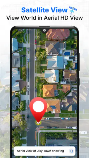
The satellite view changes the way I read a location. Streets, blocks, open ground, buildings, and larger landmarks can feel easier to connect when I see their physical layout rather than only a simplified road diagram. That can be useful when I am approaching a destination with a large parking area, a complex building, a park, or several entrances. A traditional map may tell me the street name, while the satellite image can help me understand what the place actually looks like around the road.
I also like this approach for orientation before leaving home. If I am visiting an unfamiliar neighborhood, I can inspect the shape of the roads and the surrounding spaces before starting the trip. This gives me a mental picture that can be more memorable than a list of directions. For someone who finds visual landmarks easier to remember than street names, that is a meaningful advantage.
However, satellite imagery is not automatically clearer. Dense urban areas can become visually busy, especially when roads, rooftops, trees, shadows, and map labels overlap. A user with reduced visual acuity may prefer a simpler standard map with strong road contrast. I would not assume that the most realistic view is the most readable view. The best choice depends on whether I am trying to recognize a place visually or follow a route with minimal distraction.
When I use the app in a moving vehicle, I would prepare the destination before setting off rather than trying to study the imagery while driving. The visual detail is useful during planning, but it can compete with attention on the road. A passenger can explore the display more safely, while the driver should keep interaction to the absolute minimum and rely on the route guidance only when it is easy to follow.
The current version is 2.8.0, and the app runs on devices using Android 7.0 or later. That broad system compatibility is helpful for people who keep an older phone instead of upgrading frequently. At the same time, an older device may make map interaction feel less comfortable if the screen is small or performance is limited. I would test the map at home first, particularly if I depend on large text, steady zooming, or quick screen response.
Reading the screen without unnecessary effort
One practical habit improved my experience: I used the satellite layer for orientation, then switched my attention to the route itself instead of leaving the most detailed view on screen all the time. Satellite imagery is excellent for answering questions such as “Which side of this open area is the entrance?” It is not always the easiest background for reading every road label.
People who need larger visual targets should also consider how much of the map they can comfortably inspect at once. Zooming in may make individual roads easier to study, but it reduces the surrounding context. Zooming out restores context while making small details harder to distinguish. That trade-off is not unique to this app, but it matters more here because the imagery itself contains so much visual information.
I found the app more comfortable for short planning sessions than for prolonged map browsing. A user who gets eye strain from detailed images may prefer to identify the destination, note the important landmarks, and close the app rather than continuously exploring. This is a small workflow change, but it makes the experience more manageable.
Motor and sensory considerations in everyday use
Map apps demand repeated gestures: tapping a destination, dragging the view, zooming, and sometimes correcting an accidental movement. For me, Satellite Map Live Earth View is easiest when I slow down and make one deliberate change at a time. Rapid exploration can move the map away from the area I intended to inspect, especially on a compact phone.
That matters for users with limited fine-motor control or hand tremors. A satellite map can be useful because it provides visual confirmation of where I am looking, but it can also be frustrating if a small gesture causes an unwanted zoom or shift. I would recommend using the app while the phone is supported on a table or held with both hands. A stable position reduces the need for precise one-handed movements.
There is another motor consideration that is easy to overlook: route planning is more demanding when I am in a hurry. If I am standing outside a station, carrying bags, or trying to help someone reach a destination, I have less patience for repeated corrections. In that situation, the app works better when I set up the route before arriving at the confusing location. Preparing in advance turns the phone from an active problem-solving tool into a quick reference.
For users with hearing loss, a map-centered experience can be more dependable than relying entirely on spoken prompts, because the visual route remains central to the task. I still would not assume that every important instruction can be understood visually in every situation. Before depending on it for a complicated journey, I would check how comfortably I can follow the displayed route with sound turned down or off.
Users with low vision may appreciate the ability to enlarge an area through zooming, but enlarged imagery does not necessarily mean enlarged labels or stronger contrast. Buildings and roads can become easier to recognize while text remains difficult. In my view, this makes the app more suitable for landmark-based orientation than for anyone who needs every instruction presented in a highly adjustable, high-contrast format.
Color perception can also affect the experience. Satellite imagery uses natural variations in vegetation, pavement, rooftops, and shadows rather than a deliberately simplified color system. If I cannot distinguish certain shades easily, I would use recognizable shapes and road alignment as the main clues instead of depending on color alone. This is one reason I prefer to verify a route using more than a single visual signal.
A realistic trip where the visual approach helps
Imagine I am taking an older relative to a medical building in an unfamiliar part of town. We know the address, but the destination sits beside several similar structures and a large open area. Before leaving, I can use the satellite view to understand which building appears closest to the road and where the surrounding access roads lead. When we arrive, that visual memory may help us identify the correct approach without circling repeatedly.
This scenario shows where the app can support different abilities. My relative may not want to interpret a dense set of written directions, while I may find a recognizable building outline easier to explain: “We are looking for the long building beside the open lot.” The app does not remove every navigation challenge, but it can give us a shared visual reference.
The same method can help a traveler meeting friends at a park, a parent locating a sports facility, or a visitor trying to identify a large venue among several nearby buildings. In each case, the value comes from preparing a visual landmark before the pressure of the real-world situation begins.
Situational access: when the app fits different environments
Accessibility is not only about permanent ability. It also changes with context. A person who normally reads a map comfortably may struggle in bright sunlight, while someone with steady hands may find repeated gestures difficult when walking over uneven ground. I found Satellite Map Live Earth View most useful when I could pause, enlarge the area, and compare the image with what I saw around me.
Bright outdoor conditions are a genuine challenge for any phone map. Satellite imagery can lose clarity through glare, and darker areas of the image may be difficult to interpret. I would increase screen brightness before going outside, keep the display clean, and avoid depending on tiny details at the last moment. If the destination is important, I would inspect it indoors first and remember one or two large landmarks.
At night, the visual comparison works differently. A satellite image may show the shape of a road or building, but it cannot guarantee that the same features are easily visible in darkness. I would treat the imagery as a planning aid rather than a promise that I can identify every entrance after sunset. A well-lit street sign or a clearly marked building entrance may still be more useful in the moment.
For people who get overwhelmed by crowded visual interfaces, the app may be easier when used in short stages. First locate the general area, then zoom into the destination, then stop exploring once the relevant landmark is clear. This prevents the map from becoming an endless search through details. It also reduces the number of gestures required, which helps when concentration or dexterity is limited.
Travelers should also think about connectivity before relying on any map application. I would not begin an unfamiliar journey assuming that a live map will behave exactly the same way in every location. Before leaving, I would open the destination, understand the surrounding roads, and keep the address or meeting details available in another form. That simple backup is especially important for users who cannot easily improvise if the map becomes difficult to read.
The app can be useful for passengers, cyclists planning a route, pedestrians checking a neighborhood, and drivers preparing before departure. The right workflow changes for each person. A pedestrian may have time to compare landmarks; a driver needs a glanceable route and should avoid extended interaction; a passenger can explore more freely and help interpret the surroundings.
Remaining barriers and practical trade-offs
The first limitation is that a satellite view can create confidence without answering every practical question. Seeing a building from above does not tell me whether an entrance is open, whether a path is suitable for a wheelchair, or whether a surface is easy to cross. I would never treat the image as proof of step-free access, accessible parking, curb cuts, or safe pedestrian conditions.
This is particularly important for wheelchair users, people using walkers, and anyone who needs a predictable route surface. The app can help with broad orientation, such as identifying the position of a building relative to a road, but it should be paired with current local information when physical access matters. Aerial imagery may not reveal slopes, temporary barriers, narrow passages, or the condition of a sidewalk.
People with cognitive disabilities may benefit from the visual context, but too many map details can also make decision-making harder. I would create a simple plan with one destination and a small number of landmarks rather than asking the user to navigate by continuously scanning the entire screen. A companion can help by translating the image into plain instructions, such as “follow the road until the large rectangular building appears on your left.”
The app is free, which lowers the barrier to trying it. It includes in-app purchases ranging from $1.49 to $9.49 per item, so I would pay attention to any optional upgrade screen and decide whether the free experience already covers my needs. For a person managing a tight budget, the ability to start without paying is welcome, but it is still sensible to understand which parts of the experience require an extra purchase before building a routine around them.
Its 3.9 average from around 7,200 ratings presents a balanced signal. Many people clearly find a reason to install it, but the rating also suggests that expectations should be realistic. I would not choose it solely because it offers a satellite-style view if my top priority is the most refined navigation system available. Established mainstream map services may be a better fit for users who need extensive place information, strong transit planning, detailed cycling directions, or a familiar accessibility ecosystem.
On the other hand, those alternatives can feel overloaded when I only want to understand the shape of a location. Satellite Map Live Earth View has a more focused appeal: it encourages me to look at the physical environment and use that visual understanding as part of navigation. That distinction is useful. It is not necessarily competing on every feature; it is valuable when the aerial perspective is the part I actually need.
I would also skip it if I wanted a dedicated tool for accessibility routing. A general satellite image cannot replace route information designed around mobility needs, and I would look for an option that explicitly supports the particular barriers I face. Likewise, someone who dislikes visual maps or prefers spoken guidance may find the app less comfortable than a voice-first navigation solution.
My inclusive verdict after using it
Satellite Map Live Earth View is a worthwhile free option for visual orientation, especially when a conventional road map does not give me enough sense of the surrounding buildings and open spaces. I like using it before a trip, when I have time to inspect the destination and build a simple mental picture. It can also help a passenger or companion explain a location in concrete visual terms.
Its inclusive value is strongest when the user can control the pace: prepare the route indoors, zoom carefully, use large landmarks, and avoid studying the screen while moving through a hazardous environment. Those habits make the app more approachable for people dealing with glare, limited dexterity, visual overload, or unfamiliar surroundings.
Still, I would not describe it as universally accessible. Detailed imagery may be harder to read than a simplified map, and the visual view does not establish whether a real-world route is physically accessible. Users who need high-contrast presentation, specialized mobility information, dependable offline planning, or a mature voice-navigation workflow should compare it with alternatives before making it their primary tool.
The developer, GPS Driving & Voice Navigation Apps, positions this as a travel and local app built around current location, route discovery, and satellite mapping. In practice, I see it as a useful second opinion for the landscape around a destination. It is particularly good for answering “What will this place look like from above?” before I arrive.
My recommendation is simple: try it if visual landmarks help you navigate and you want a no-cost way to explore an area from a different perspective. Prepare important journeys in advance, keep a backup for critical directions, and do not confuse an aerial image with confirmation of physical access. Used with those limits in mind, the app’s strongest feature is the extra context it gives to people who navigate better when a place feels visually familiar.


